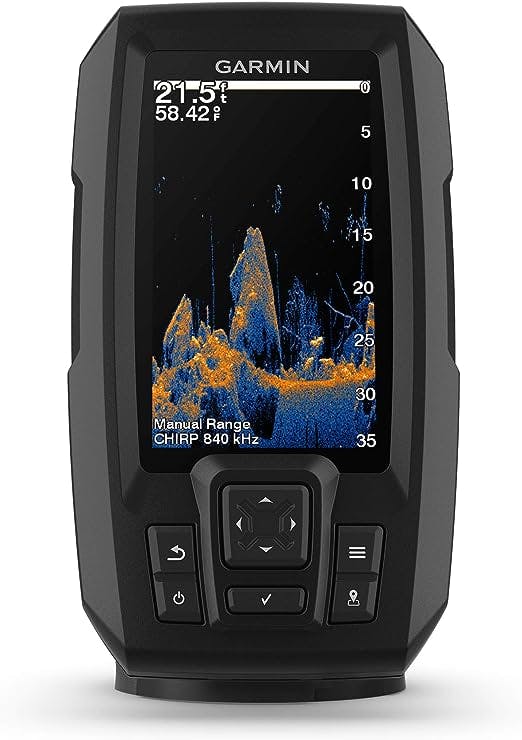
Spotlight Pick

Garmin Striker Vivid 9sv - 5" Color Fishfinder
4.7 / 5
Balanced option for paddlers who want a high-confidence all-round setup with strong value retention.
Loading experience...
Product Breakdown
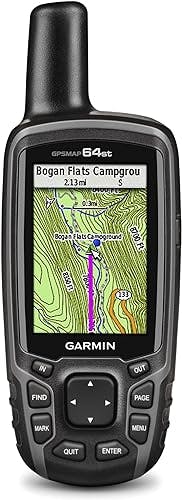
Garmin GPSMAP 64st: High-Sensitivity GPS with TOPO U.S. 100K
Opens the retailer in a new tab. Availability and pricing can change without notice.
Deep Dive
The Garmin GPSMAP 64st is a rugged and full-featured handheld GPS device that is perfect for outdoor adventures. With its 2.6" sunlight-readable color screen, you can easily view maps and navigate. The high-sensitivity GPS and GLONASS receiver with a quad helix antenna ensure superior reception, even in challenging environments.
GPSMAP 64st comes preloaded with TOPO U.S. 100K maps and includes a 1-year BirdsEye Satellite Imagery subscription. This means you have access to detailed maps and satellite images of the full U.S., including Alaska, Hawaii, and Puerto Rico. You can explore national parks, forests, trails, rivers, lakes, and points of interest.
The device also features a 3-axis compass with a barometric altimeter, allowing you to get your bearings and track changes in pressure for accurate altitude readings. You can even plot barometric pressure over time to monitor changing weather conditions.
With wireless connectivity via Bluetooth technology or ANT+, you can share your waypoints, tracks, routes, and geocaches wirelessly with other compatible devices. You can also connect to Garmin devices and accessory sensors like the VIRB action camera, tempe temperature sensor, foot pod, and heart rate monitor.
The GPSMAP 64st has a quad helix antenna and high-sensitivity GPS and GLONASS receiver, ensuring quick and precise positioning. It maintains its location even in heavy cover and deep canyons, making it a reliable companion in any environment.
In terms of storage, the device comes with 8GB of onboard memory and a microSD card slot. You can easily add more maps, such as topographic, marine, and road maps. It is also compatible with Garmin Custom Maps, allowing you to transform paper and electronic maps into downloadable maps for your device.
If you're into geocaching, GPSMAP 64st supports paperless geocaching with 250,000 preloaded caches from Geocaching.com. It stores and displays key information like location, terrain, difficulty, hints, and descriptions. Plus, it has a battery life of 16 hours, making it perfect for outdoor pursuits.
BaseCamp software lets you view and organize maps, waypoints, routes, and tracks on your computer. You can even create and share Garmin Adventures with friends and family. BaseCamp displays topographic map data in 2-D or 3-D, including contour lines and elevation profiles. It can also transfer satellite images to your device when paired with a BirdsEye Satellite Imagery subscription.
Now, let's move on to some frequently asked questions about the Garmin GPSMAP 64st:
Q: Will the 64st have some road capability along with the 100K topo? Also want to add 24k Mid atlantic, does unit have an extra SD slot? Is it micro?
A: The 64st only comes with the US 100k topos, but you can add routable road maps for the whole USA by purchasing additional navigator maps from Garmin or using free maps from openmapchest.org. The unit does have an extra micro SD slot under the battery.
Q: Will this device record my entire hike or trip, showing time, distance, and elevation once complete?
A: Yes, the device will record your entire hike or trip. Make sure to clear the previous track before starting a new one. Once you complete the hike/trip, save the track with a fitting name so you can load it into BaseCamp or MapSource.
Q: Does this device have a distress beacon or other emergency locating features?
A: Garmin offers the inReach Explorer+ device, which has a fully functional GPS, emergency location feature, 2-way satellite texting capability, and weather updates. However, it has additional costs, an internal battery, and limited replaceability.
Q: Can the device access information from storage cards larger than 8GB?
A: As long as it is a 'class 10' memory card, the device should be able to access information from cards up to 64GB without any issues.
I have the 64s. The 64st only has the US 100k topos included. I have the Garmin Southwest and West 24k maps loaded. If you want ROUTABLE road maps for the WHOLE USA you can get the navigator maps from Garmin or use the free ones which I use from openmapchest.org. They are very good. I have ALL the maps loaded on the SD card at once and it is easy to switch between them. The unit does have a micro SD slot under the battery.
Yes it will record the entire hike or trip. Important though is to clear the previous track before starting a new one, once you are at the start of your new trip. Then when you complete the hike/trip save the track with a fitting name so you can then load it into basecamp or the much more useful earlier version , mapsource.
Garmin does make a device now that has a fully functional GPS, with an emergency location feature, 2-way satellite texting capability (so you can text people on their mobile phones when you are out of mobile range), and also provides weather updates. It is called the inReach Explorer+ and retails for ~$450. However, along with its benefits, here are a few drawbacks. You have to sign up for either a monthly or annual communication plan (they range from $11 to $100 USD/mo depending on the features you want), it also has an internal battery that you'll have to recharge on long trips, and though it should last a while, I don't know if it can be replaced.
As long as it is a 'class 10' memory card it should work. Some people use up to 64gb cards with no problem.
Alternatives
A curated comparison lane to quickly spot stronger options.
Spotlight Pick
Balanced option for paddlers who want a high-confidence all-round setup with strong value retention.
Read Next
A focused editorial path so readers can keep momentum after this review.
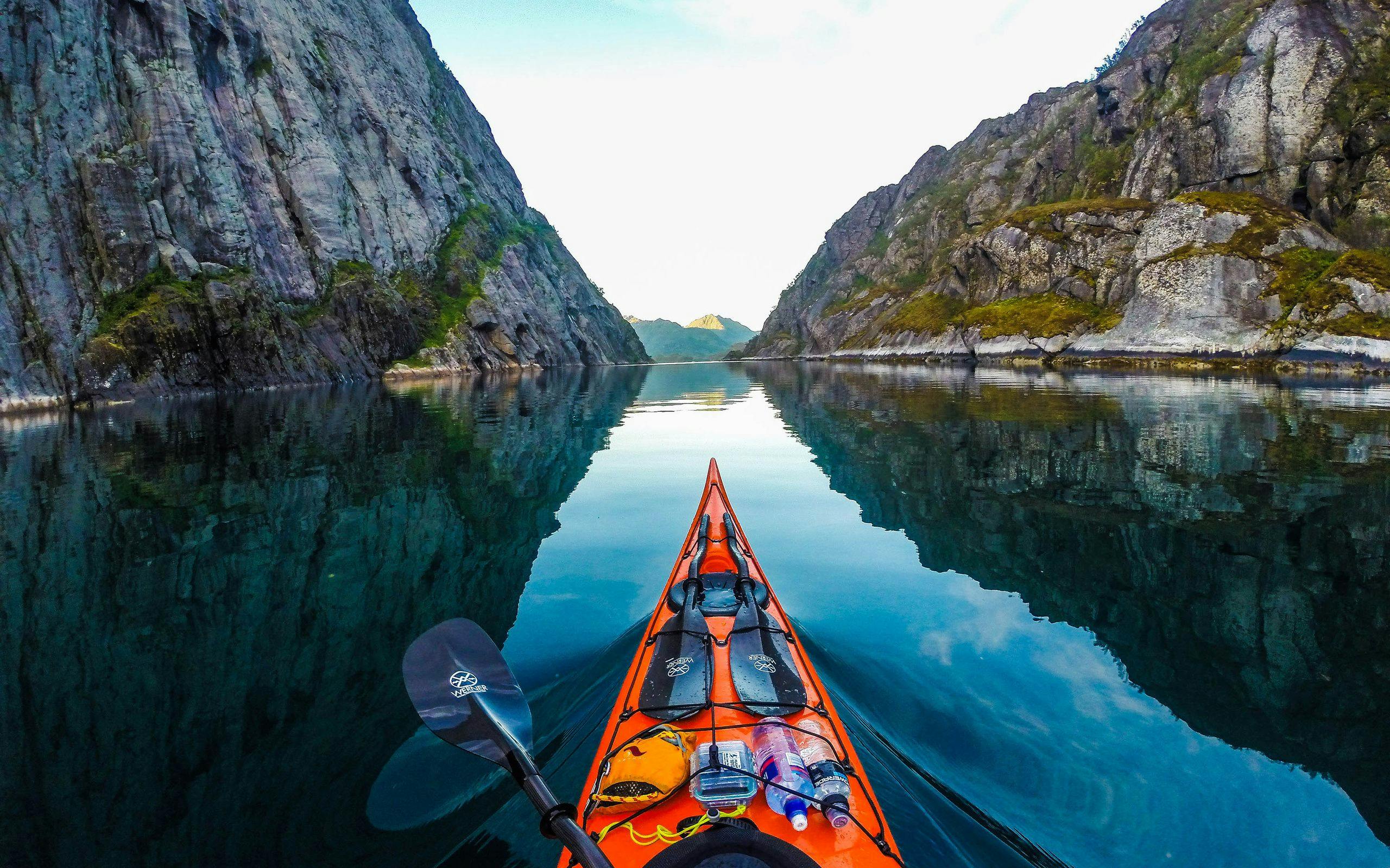
 Shop KayaksFeatured
Deep dive first: this article expands the strategy, gear, and route decisions that complement the product you are viewing now.
Read featured guide